GPSSC Trail view.
Screen examples.
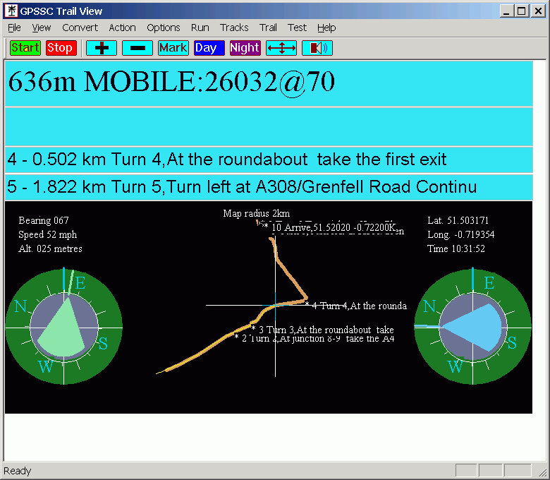
With a Gpolyline loaded.
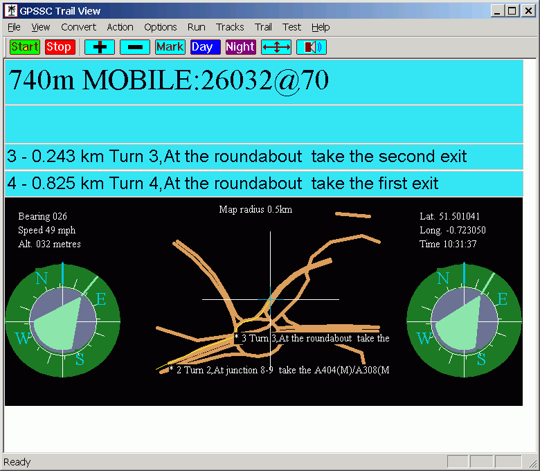
With a wiki openstreetmap gpx loaded.
Trail view is another variation on the route and pointer views. This view has two compasses and can display a Google maps Gpolyline or GPX containing a map.
The nearest point of your route is displayed on line 3. The next point is displayed on row four. The distance on each line is the straight line distance from your current location to the point.
The outer ring of each compass both display your current direction. This is at the blue line at the top of each compass.
The arrow of the left compass points from your current location towards the nearest route point.
When you are closest to the nearest point the arrow of the right compass is green and points from the nearest route point to the next route point. When you are closest to the next point the arrow of the right compass is blue and points from the next route point to the following route point. So typically when you have a left turn ahead the blue arrow points left and when you have right turn ahead the blue arrow points right.
To load a Google map Gpolyline or map GPX use the Trail Menu. You can create a suitable GPX file from Google map directions by using my web site at http://www.stevematt.f9.co.uk/googlemap/iegmap.html and the GPolyline to GPX button. You can also load other small route or track GPX files such as a Wiki openstreetmap GPX and this will give you a basic no thrills map in the Trail view. The trail view is intended to be used with a Google map Gpolyline and if you use it with maps then you will find it can't cope with drawing large maps. If you use a larger map then you have to be zoomed in so that only a small section of it is displayed otherwise the display wont update. When you have finished using a trail you might want to unload it to free up the memory it was using. If you don't it is not a problem as it is unloaded automatically when you exit the program.
Back to the main GPSSC web page.
http://www.stevematt.f9.co.uk/ukspeedcamera/gpssc.html
Other things
My Googlemap .gpx route or track uploader and creator web page.
http://www.stevematt.f9.co.uk/googlemap/iegmap.html
Fix for Windows jumping mouse problem. This is handy if you are using a USB GPS. Especially if you plug your GPS into several ports.
http://www.stevematt.f9.co.uk/FixSerial/fixserial.htm
GPS NMEA Builder utility for MS Windows - Creates a set of GPS NMEA $GPGGA strings from a set of POI (point of interest) co-ordinates. Useful for simulating the $GPGGA strings a GPS would create for a route.
http://www.stevematt.f9.co.uk/ukspeedcamera/GPSNMEABuilder.html
Last updated 29 March 2009.